The 2009 Oceansat-2 Launch That Put India on the Global Space Map

On 23 September 2009, India achieved a milestone in space technology with the successful launch of PSLV-C14, carrying the Oceansat-2 satellite along with six international nano-satellites. This mission not only showcased ISRO’s growing technological prowess but also reinforced India’s capability as a reliable player in the global space industry. Oceansat-2 was designed to monitor ocean color and atmospheric conditions, significantly boosting applications in weather forecasting, agriculture, and climate research. By combining scientific innovation with commercial success, the PSLV-C14 mission marked a turning point in India’s space journey, solidifying its strategic goals and expanding its influence on the world’s satellite launch market.
Mission Overview and Objectives
On 23 September 2009, at 06:21 UTC, ISRO’s reliable PSLV-C14 (Core‑Alone configuration) rose from the Satish Dhawan Space Centre, Sriharikota, placing Oceansat‑2 into a 720 km sun‑synchronous orbit. This mission marked ISRO’s 16th remote-sensing launch. PSLV‑C14, standing 44.4 m tall and weighing 295 t at liftoff, incorporated upgraded avionics and a liquid-fueled fourth stage to enhance precision for sun-synchronous missions.
Payload Details
PSLV‑C14 delivered Oceansat‑2 (960 kg) alongside unprecedented commercial payloads: six international nanosatellites. This included Germany’s Twin Rubin‑9.1/9.2, SwissCube‑1, BeeSat, UWE‑2, and Turkey’s ITUpSAT‑1. Oceansat‑2 hosted three key instruments: ISRO’s Ocean Colour Monitor‑2 (OCM‑2) and Ku‑band scatterometer (SCAT), plus Italy’s Radio Occultation Sounder (ROSA). The mission exemplified ISRO’s dual-edge strategy, meeting scientific goals while offering commercial launch services for CubeSats, demonstrating cost-effective multi-payload deployment expertise.
Purpose and Applications
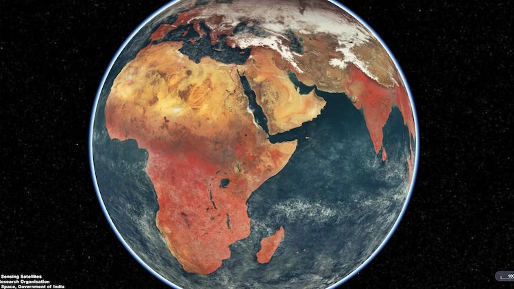
Oceansat‑2’s primary mission was to monitor ocean color and atmospheric aerosols, derive phytoplankton concentration, and study surface winds and suspended sediments. The OCM‑2 offered eight-band imaging across visible to near‑IR wavelengths (swath 1,420 km), enabling chlorophyll mapping and phytoplankton bloom detection. The Ku-band scatterometer tracked global wind vectors, while ROSA provided atmospheric density profiles. These instruments fuelled applications in fisheries management, coastal monitoring, climate research, and weather forecasting. Oceansat‑2 ensured continuity of Oceansat‑1 services, strengthening India’s marine and atmospheric data infrastructure.
Scientific and Technological Accomplishments
The PSLV‑C14 mission was a testament to ISRO’s growing technological maturity, achieving its fifteenth consecutive successful PSLV flight. The launch employed a refined core‑alone configuration, integrated with new AMC/ATS‑based avionics and quaternion‑based orbital computation techniques, both firsts in an SSPO mission. Such enhancements enabled smoother guidance, better payload management, and precise orbital insertion. The vehicle successfully placed Oceansat‑2 and six nanosats into a 720 km sun‑synchronous polar orbit, highlighting PSLV’s reliability, flexibility, and ability to serve both scientific and commercial goals.
Development and Deployment of Oceansat‑2 with Improved Oceanographic Sensors
Launched with a mass of 960 kg, Oceansat‑2 was engineered to continue and build on Oceansat‑1’s legacy, carrying advanced payloads in a compact, modular bus optimised for Earth observation. Its solar panels generate 1,360 W of power, enough to support continuous operation across a five‑year mission life. The satellite delivered high‑resolution imagery over a wide swath, enabling precise monitoring of oceanic parameters such as chlorophyll concentration, phytoplankton blooms, suspended sediment, and atmospheric aerosols. Its enhanced design significantly boosted the application potential across weather, climate, and environmental monitoring domains.
Use of Three Key Instruments: OCM‑2, Ku‑band Scatterometer, and Radio Occultation Sounder
Oceansat‑2 carried three critical payloads: the eight‑band Ocean Colour Monitor (OCM‑2) operating in visible and near‑infrared bands with 360 m resolution over a 1,420 km swath; the Ku‑band pencil‑beam scatterometer (SCAT) rotating at 20 rpm with a 1 m antenna at 13.515 GHz for surface wind vector determination; and the Radio Occultation Sounder for Atmosphere (ROSA), a GPS‑based instrument from the Italian Space Agency providing atmospheric and ionospheric profiling via radio occultation techniques.
First‑Time Use of Ku‑band Scatterometer in Indian Satellites
The Ku‑band scatterometer aboard Oceansat‑2 marked a pivotal advance, being the first of its kind flown on an Indian platform. Operating at 13.515 GHz with a 1 m rotating antenna, it could resolve ocean surface winds with high spatial coverage (1,400 km swath) and revisit every two days. This capability enabled accurate sea‑surface wind vector retrieval using dual‑beam conical scanning, a significant upgrade over the earlier scatterometer on Oceansat‑1. The precise wind data greatly improved marine meteorology, cyclone tracking, and ocean dynamics modelling from an indigenous platform.
Enhancement of India’s capabilities in weather forecasting, disaster warning, monsoon prediction and cyclone tracking
The Oceansat‑2 mission aboard PSLV‑C14 significantly deepened India’s ability to forecast weather events. Its Ku‑band scatterometer provided precise sea surface wind vectors every few hours, while the Ocean Colour Monitor (OCM‑2) tracked chlorophyll and aerosols to support cyclone trajectory prediction and monsoon onset monitoring. These instruments jointly fed critical inputs to the India Meteorological Department, bolstering its early warning systems. For instance, during Cyclone Fani in 2019, data from Oceansat‑2, along with Scatsat‑1 and INSAT, were instrumental in tracking wind speed, direction and intensity, helping save countless lives.
Support for marine fisheries, coastal security, and water resource management
By utilising OCM‑2 and sea surface temperature data, Oceansat‑2 empowered INCOIS to generate Potential Fishing Zone (PFZ) advisories, guiding fishing vessels to high‑catch regions and reducing fuel costs substantially. Fishermen benefited through improved yields and savings, estimated at ₹1‑6 lakh per trip, while coastal managers gained tools to monitor algal blooms, sediment plumes and pollution. These capabilities also reinforced maritime domain awareness, aiding coastal security. Simultaneously, oceanographic mapping improved water resource planning in estuaries and coastal aquifers by identifying sediment transport and coastal erosion patterns.
Boosted indigenous remote sensing programmes for agriculture, forestry, and climate studies
Oceansat‑2 strengthened India’s remote sensing ecosystem by supplying continuous oceanographic and atmospheric data to platforms such as MOSDAC, VEDAS and Bhuvan. These datasets enriched crop forecasting systems like FASAL and NADAMS by including ocean‑aerosol parameters that influence monsoon rains. Satellite‑derived vegetation indices improved monitoring of forest cover, drought zones and land use, feeding into national initiatives under the National Natural Resources Management System. Over time, ISRO’s integration of satellite data into agriculture, forestry and disaster mitigation enhanced decision intelligence across sectors, bridging science and policy.
International Collaboration and Global Recognition
On 23 September 2009, ISRO successfully launched PSLV-C14, carrying India’s Oceansat-2 satellite along with six foreign nanosatellites from Germany, Switzerland, and Turkey.
These included:
- Four CubeSats from Germany (developed by universities such as the Technical University of Berlin),
- SwissCube-1 from Switzerland (EPFL – École Polytechnique Fédérale de Lausanne),
- ITUpSAT-1 from Turkey (Istanbul Technical University).
- These foreign payloads were launched under commercial agreements, coordinated by ISRO’s commercial arm Antrix Corporation, demonstrating India’s ability to provide reliable and timely services to international clients.
- This mission significantly strengthened ISRO’s position in the global satellite launch market by highlighting:
- Its technical reliability,
- Its cost-effective launch services, and
- Its ability to handle multi-payload missions with international collaborations.
- By delivering all payloads into their intended orbits with precision, ISRO reinforced its growing image as a trusted global launch partner, especially for small and educational satellites.
- The launch success of PSLV-C14 contributed to India gaining more commercial satellite contracts in subsequent years, eventually helping ISRO build a reputation as a low-cost, high-reliability space agency.
- The international collaboration also showcased India’s ability to participate in global scientific and academic efforts, enhancing soft power and diplomatic goodwill.
- Multiple reports and think tanks noted that this mission, along with others in that period, laid the foundation for India’s entry into the competitive commercial launch arena, where it would later launch satellites for countries like the USA, UK, Canada, and Singapore.
Firsts, Milestones, and Records
First time Ku‑band scatterometer used on an Indian satellite
The 2009 PSLV‑C14 mission was a landmark for ISRO, as Oceansat‑2 carried India’s first-ever Ku‑band scatterometer, operating at 13.515 GHz with a 1‑metre diameter antenna rotating at 20 rpm. This instrument, covering a swath of around 1,400 km, significantly enhanced India’s ability to map ocean surface winds and wave conditions with unprecedented accuracy from a domestic satellite platform.
ALSO READ: “International Ozone Day 2025: All You Need to Know About the Global Fight to Protect Our Sky”
Successfully launched seven satellites in a single mission
On 23 September 2009, PSLV‑C14 successfully placed seven satellites into orbit, its primary payload Oceansat‑2 followed by six nanosatellites deployed sequentially within 20 minutes of lift‑off. This was a significant operational milestone, showcasing ISRO’s ability to manage multi‑satellite deployment with precise timing and orbital insertion. It reaffirmed PSLV’s versatility, handling commercial and scientific payloads together, and underscored India’s growing competence in launching clustered satellites safely and efficiently.
Reinforced the credibility of the PSLV workhorse, continuing its flawless streak
PSLV‑C14 marked the 15th consecutive successful flight of the PSLV, reflecting the rocket’s unmatched reliability since its first successful mission in 1994. At launch time, the PSLV had already built a formidable track record, 16 missions flown, with only the inaugural flight having failed. As ISRO Chairman G. Madhavan Nair remarked, “With age, it only improves.” The success of C14 further cemented PSLV’s reputation as a dependable, robust launch platform capable of a wide range of mission profiles, reinforcing confidence among domestic and international customers.
Helped ISRO emerge as a commercial satellite launch provider for small and nano‑satellites By placing six international nanosatellites, among them SwissCube‑1 (Switzerland’s first satellite) and ITUpSAT1 (Turkey’s first), alongside the Indian payload, PSLV‑C14 highlighted ISRO’s expanding commercial launch credentials. These missions were flown under commercial arrangements through Antrix, ISRO’s marketing arm, enabling the agency to demonstrate low‑cost, reliable launch services. The mission thus helped establish India as a credible global provider for small and university‑built satellites, paving the way for a growing stream of international contracts in subsequent years.
Long-term Contributions to India’s Space Program
Data from Oceansat‑2 was used for over a decade for ocean and weather studies
Launched aboard PSLV‑C14 on 23 September 2009, Oceansat‑2 collected high‑resolution data on ocean color, wind vectors, atmospheric aerosols, chlorophyll concentration, suspended matter and sea-state parameters. Its payload suite, including OCM‑2, OSCAT and ROSA, enabled reliable identification of potential fishery zones, algal bloom detection, monsoon onset prediction and coastal resource management. For more than a decade, this operational continuity served national users and international communities, supporting climate research, fisheries forecasts and monsoon models based on time‑series data from the OCEANSAT programme.
The mission laid groundwork for Oceansat‑3, launched in 2022
By sustaining ocean‑color and surface‑wind data streams, Oceansat‑2 directly enabled the planning and design of its successor Oceansat‑3 (EOS‑06), launched on 26 November 2022. Oceansat‑3 carries an advanced 13‑band OCM‑3, Ku‑band scatterometer (SCAT‑3), and sea‑surface temperature monitor (SSTM), expanding applications to biogeochemical modelling, algal bloom tracking, carbon cycling and monsoon dynamics.
PSLV‑C14 strengthened PSLV’s reputation, boosting confidence for major missions like Chandrayaan‑1 and Mars Orbiter Having achieved a flawless insertion of Oceansat‑2 with six nanosatellites, PSLV‑C14 further cemented the PSLV workhorse legacy of reliability. By the time of ISRO’s centennial launch milestone in early 2025, PSLV had completed at least 62 missions, injecting Chandrayaan‑1 (2008) and Mars Orbiter (2013) into their trajectories seamlessly.
The success of PSLV‑C14 demonstrated ISRO’s growing capability in multi‑payload integration and deployment
Carrying not only the 958 kg Oceansat‑2 but also six international nanosatellites, PSLV‑C14 validated ISRO’s proficiency in coordinating complex multi‑payload missions. This laid the groundwork for later rideshare and commercial launches, as seen in PSLV‑C54/Oceansat‑3 and numerous foreign nanosatellite deployments. The mission showcased refined mission‑integration practices, payload sequencing, and orbital deployment, all instrumental in scaling ISRO’s commercial viability and global partnerships.
.png)